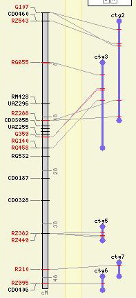
Normally, all maps are drawn to the full height available in the image, like the map on the left in this image. No effort is made to scale maps to one another, even if they are in the same map units (e.g., one "centimorgan" can represent different distances in different studies).
When a relational map is drawn next to a reference map, however, it is drawn to a length in pixels equal to the distance covered by all the correspondences on the reference map. The contigs shown to the right demonstrate this. In the cases of "ctg2" and "ctg3," the tops and bottoms of the maps are equal (more or less) to the top and bottom positions of the correspondences. The other three contigs, have either just one correspondence or have all their correspondences clustered in one location on the reference map, so they are drawn to a minimum pixel height.
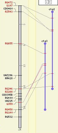
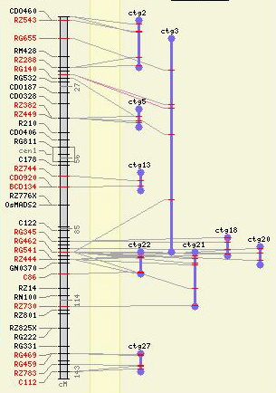
The placement of features on the relational maps works just it does for any other map. They are drawn at a location relative to their distance along the map -- that is, the entire pixel length of the map is assumed to represent the entire relational map, and features are placed at a pixel distance on the map equivalent to their start/stop positions divided by the overall length of the map.
You can determine the shape, color and width of the maps in a relational map set just as you would any other map.